
Property Risk Map
A property risk map visually highlights potential hazards and concerns for specific real estate locations.
A property risk map visually highlights potential hazards and concerns for specific real estate locations.
Start Assessing Your Property.
Complete the information below.
ADEC SiteRisk Property Risk Map
Harness comprehensive data to make informed property investments with confidence.
Utilize precise risk assessments to safeguard and enhance your property's worth.
Simplify due diligence and development processes with consolidated, actionable insights.
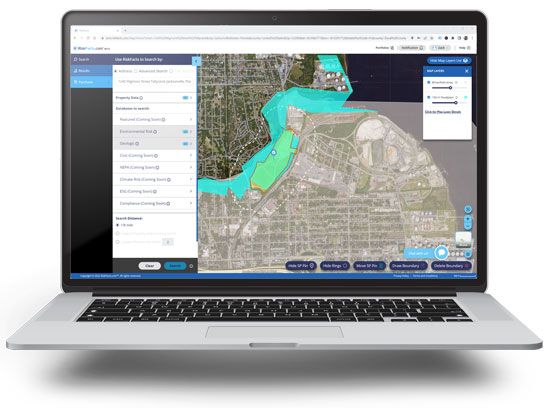
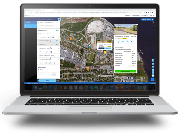
The Property Risk Map is a wide-ranging tool designed to evaluate and present potential environmental risks associated with a specific property or area. This tool allows users to search through vast databases, often encompassing millions of records from thousands of sources, to identify potential hazards, liabilities, and opportunities related to a subject property. Such risks can range from environmental concerns like brownfields, superfund sites, and flood zones to other influential factors like pipelines and federal wetlands. By understanding these risks early in the transaction process, stakeholders can make informed decisions, mitigate potential issues, and strategize for sustainable and resilient development.
Having a robust understanding of potential risks associated with a property is extremely beneficial. Utilizing a property risk map offers industry professionals a competitive edge, ensuring informed decisions and optimized outcomes.
 Risk Clarity
 Data Precision
 Time Efficiency
 Strategic Insight
 Asset Protection
Sign up today to stay on top of market trends, industry insights, and latest offers.
Do you have a solution that would make a good addition to the ADEC Enterprise Marketplace? Fill out the form below and we will be in touch within the next 1-2 business days.